
The map key is too small to read. This map shows the different language groups in Africa. Each color represents a "family" of languages which are similar to each other.
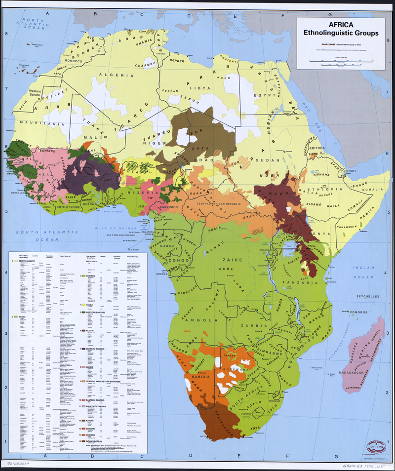
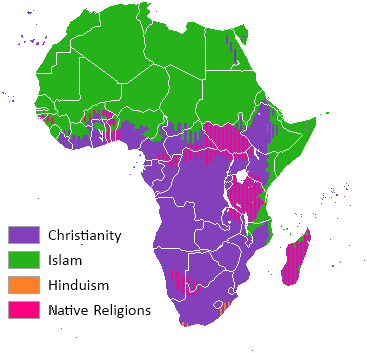
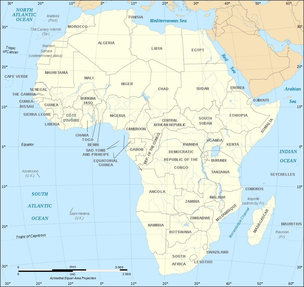
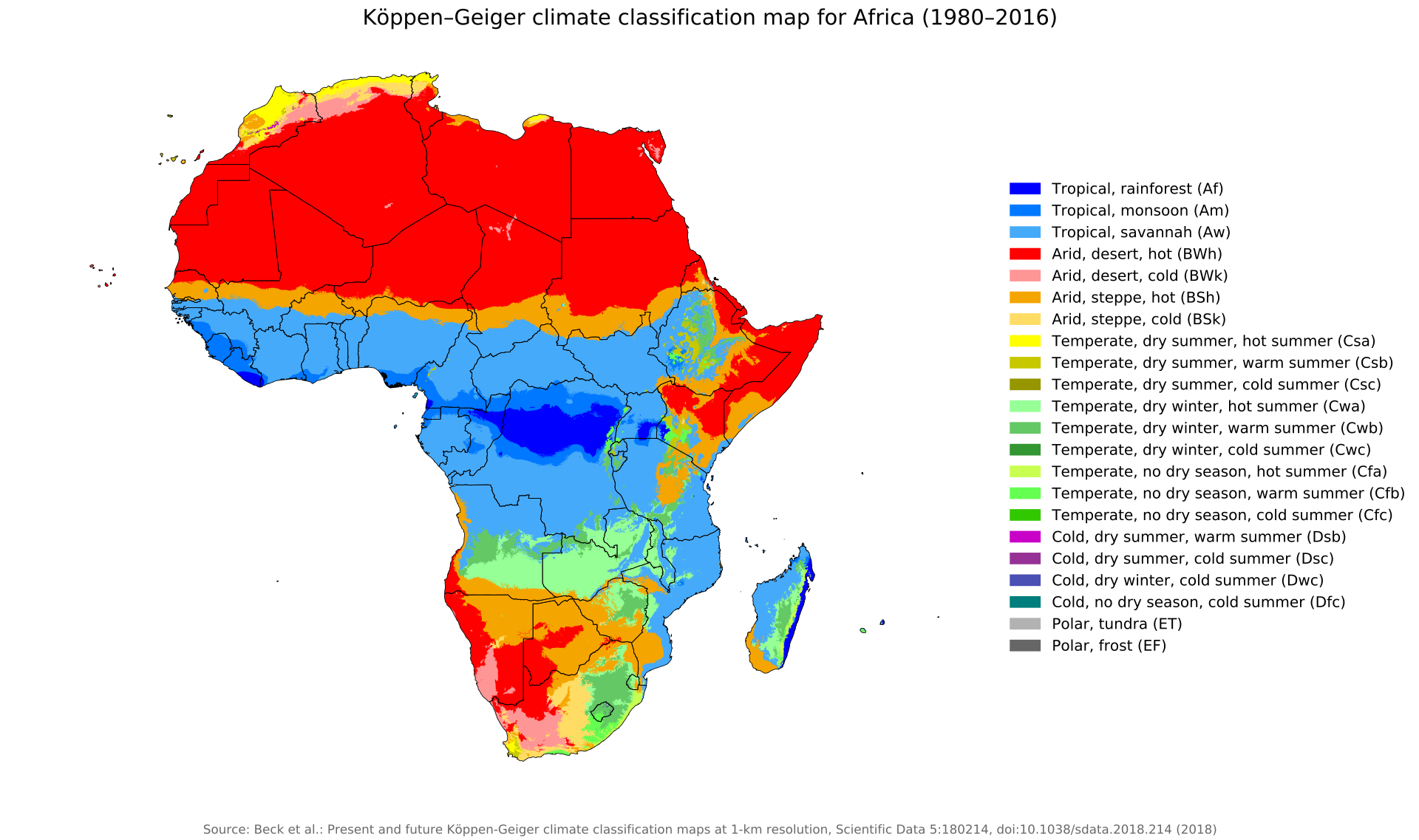
Map credits: Political: By Derivative works of this file: BobarinoAfrican continent-fr.svg: Eric Gaba (Sting - Sting) - African continent-fr.svg, CC BY-SA 2.5, https://commons.wikimedia.org/w/index.php?curid=5387989 Climate Zone: By Beck, H.E., Zimmermann, N. E., McVicar, T. R., Vergopolan, N., Berg, A., & Wood, E. F. - "Present and future Köppen-Geiger climate classification maps at 1-km resolution". Nature Scientific Data. DOI:10.1038/sdata.2018.214., CC BY 4.0, https://commons.wikimedia.org/w/index.php?curid=74672918 Religions: By derivative work: T L Miles (talk)uploader of original revision of Religion_distribution.png was Moshin - based on a vandalised revision of Religion_distribution.png [1]. Unreferenced., Public Domain, https://commons.wikimedia.org/w/index.php?curid=4361001